AI Earth Observation
The AI Earth Observation Innovation Lab is a working portal that applies AI to satellite and sensor data analysis. It hosts twelve analytical modules.
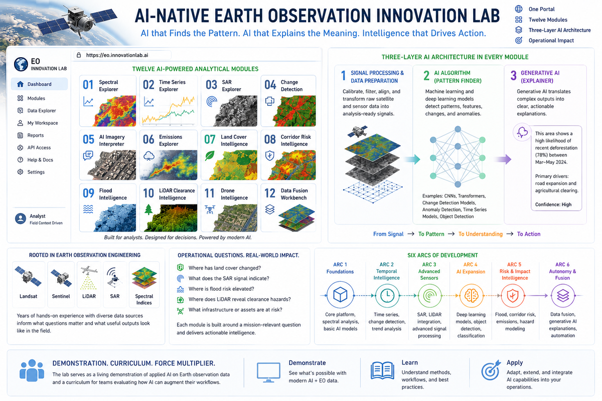
The AI-Native Earth Observation Innovation Lab is a working portal that applies modern AI to satellite and sensor data analysis. It hosts twelve analytical modules at a single URL: Spectral Explorer, Time Series Explorer, SAR Explorer, Change Detection, AI Imagery Interpreter, Emissions Explorer, Land Cover Intelligence, Corridor Risk Intelligence, Flood Intelligence, LiDAR Clearance Intelligence, and Drone Intelligence.
Each module addresses a real operational question — where has land cover changed, what does the SAR signal indicate, where is flood risk elevated, where does LiDAR data reveal clearance hazards. Every module runs a three-layer architecture: signal processing and data preparation, an AI algorithm that finds the pattern, and a generative AI layer that explains what the pattern means in plain language.
The project sits at the intersection of an engineering background in satellite data analysis and current work applying AI to operational decisions. Prior experience with Landsat, Sentinel, LiDAR, and spectral indices informs how the modules are designed — what questions matter and what a useful output looks like in a field context. Built across six arcs of development, each adding new data types and AI methods, the lab serves as both a demonstration of applied AI and a curriculum for teams evaluating how AI can augment earth observation workflows.